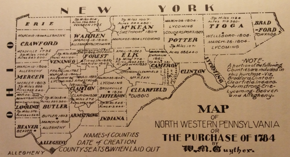
Map of 1784 Northwestern Pennsylvania Land Purchase
© Stephanie Hoover - All Rights Reserved
It is hard today to imagine the northwestern corner of Pennsylvania as untraveled wilderness. Industries as varied as Lake Erie's shipping, to natural gas drilling, to an emerging wine industry are fueling and revitalizing this corner of the state. But in the 1780s, these counties belonged to Six Nations tribes including Mohawks, Oneidas, Onondagas, Senecas, Cayugas and Tuscaroras.
On September 25, 1783, Pennsylvania's Supreme Council passed a resolution authorizing a commission to purchase Indian territory within the acknowledged boundaries of the state. This included the counties of Crawford, Warren, Venango, Forest, McKean, Elk, Potter, Tioga, Mercer, Lawrence, Butler, Clarion, Jefferson, and Cameron - as well as portions of Bradford, Clinton, Clearfield, Indiana, Armstrong, Erie, Lycoming, Beaver and Allegheny.
In early October 1783, these commissioners met with representatives of the Six Nations at Fort Stanwix (now Rome), New York. On October 23rd, they reached a deal. Although peacefully transferred, in less than 150 years Native Americans had relinquished all claims to their land in Pennsylvania.
This "Purchase of 1784," as it is now known, allowed Pennsylvania to offer Depreciation Lands to Revolutionary soldiers, sailors and prisoners of war. These land certificates reimbursed men for the depreciated currency they had received as military pay.
The following map shows the exact area included in this 1784 purchase.
Books by Stephanie Hoover...