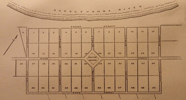
1770 Map of Wilkes-Barre, Pennsylvania
© Stephanie Hoover - All Rights Reserved
In December 1768, the rather royal-sounding "Manor of Stoke" contained the present city of Wilkes-Barre and its surrounding same-named township. The name Wilkes-Barre was bestowed by proprietor Major John Durkee, whose 1770 map of the town's original lots is displayed below.
The county of Luzerne was established on September 25, 1786 (created from part of Northumberland County) and Wilkes-Barre was named its county seat.
On March 17, 1806, Wilkes-Barre became an incorporated borough. The borough limits were slightly extended in 1870, and in 1871 Wilkes-Barre was incorporated as a city. In 1898 it became a Pennsylvania city of third class.
While this map can be useful in comparing early deeds to original plot numbers, when researching ancestors remember to also check Northumberland County records, since this is Luzerne County's parent.
Books by Stephanie Hoover...